First camper trip of my life — and as part of it two "trial days" on the
Cape Wrath Trail under properly Scottish conditions: heavy rain and gale-force
gusts at times.
The Cape Wrath Trail demands considerably more preparation than a regular
multi-day hike: unwaymarked, unbridged river crossings, no mobile signal.
Contact to the outside world was only possible by satellite communication.
The stages
Day 1 — from Fort William to Cona Glen
Atmospheric twilight over the gravel path, mist filling the valley
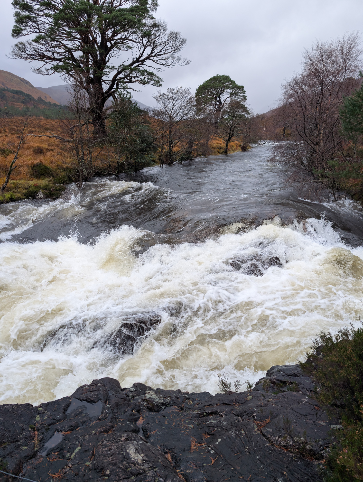
Setting off from the Roadsurfer camper — heading for the trailheadBoat crossing to the trailhead on the other shoreLoch shore just after landing, mountains in the mistOaks on the loch shore — autumn leaves still clinging, the loch hazy beyondNarrow valley road between bare birches, mountains already wrapped in cloudLone cottage along the trail, mountain flanks shrouded in cloudBurn through the bog, scattered birches — classic CWT terrainRiver through bracken and birches, mountain flanks behindSurging river on the steep slope — the last days' rain making itself feltRiver between the valley flanks, mist over the peaksRoaring waterfall — powerful water over rock stepsTent pitched, day 1 done — a quick self-check before bedInside the tent with pack, water bottle and kit — almost everything dry
I deliberately set off in heavy rain, to test the gear (and myself). My Bergans
jacket and trousers were like a mobile tent out there — brilliant!
The river level kept rising, so I didn't pitch right by the bank. The higher
spot was exposed to extreme wind and rain. But in the end my tent didn't blow
away. That's no theoretical worry, by the way: on the follow-up hike I met a
walker at the Corryhully Bothy who'd had to abandon his planned tour because
his tent blew away in the night. His eight-hour journey there had been for
nothing — bitter.
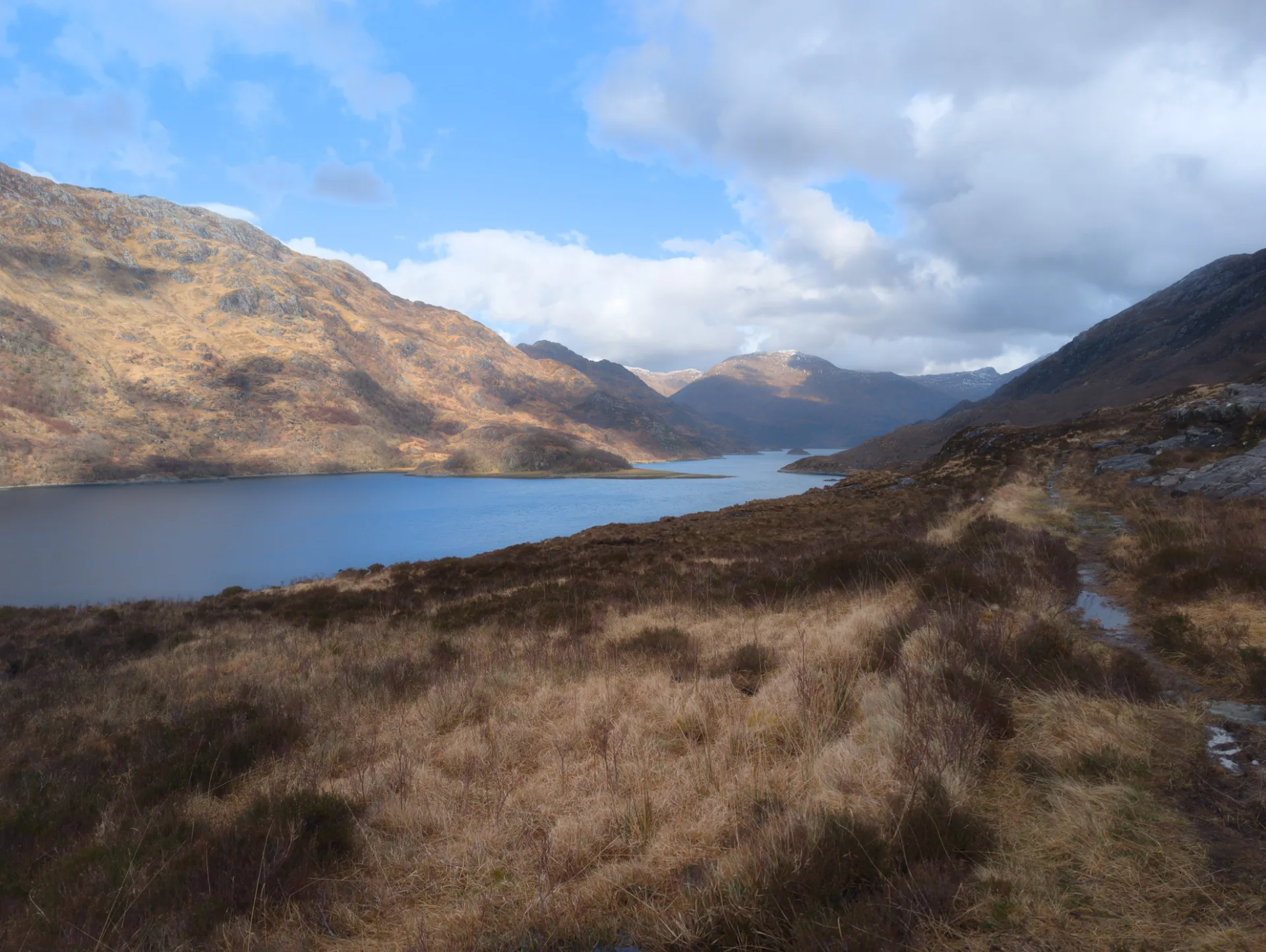
Day 2 — from Cona Glen to Glenfinnan
Highland track under dramatic clouds — a brief break of light over the ridges
Tent in the morning, day 2 starts grey — path and burn right alongsideFirst cup in the rain — the mug steams, the path stretches onA pause on the path — the pack catches its breath, so do IStony path in the open valley, heavy cloud over the mountainsPath traces across the mountain flank, heather and moor all aroundWet trail — the path under water, the mountains still in cloudPath between rocks, a wide view down the valley — back down towards GlenfinnanGnarled pines line the path, the slope rising behindLoch in the Glenfinnan valley, the path running right along the shoreLevel crossing near Fort William, Ben Nevis behind — back in civilisationBack at the camper, everything wet hanging from the awning to dryEvening reward — Thistly Cross cider from the Scottish HighlandsSalmon on mash — the reward after two wet days
This part of the tour took place on 4 November 2025; unfortunately komoot
refused to start the offline tour without an online connection (now fixed).
Luckily I had
the OS Maps app with offline maps on hand as well (and paper maps as a further
backup) — otherwise this would have been seriously awkward. The recording's
duration and average speed thankfully don't match what actually happened.
Clicking "Accept" enables Google Analytics (anonymised) for usage stats; without consent it isn't loaded. Personalised ads are handled separately through Google's own dialog.