Today Rain 23° 22°Next days
At a glance
Member benefit
Whole tour as GPX and PDF — a CARECOM.united member benefit. Membership is free and non-binding. About membership →
- First lap around Lac des Vieilles Forges
- From the lake to the Pont sur le Ruisseau de Faux
- Panorama over Revin: the loop from Anchamps
- Around the lake again — this time solo
- Roc la Tour and the view of Naux
- The island of Montcy-Saint-Pierre near Charleville-Mézières
- To the viewpoint above the Bassin de Whitaker
A week in the French Ardennes
A one-week family trip to the French Ardennes, staying in an apartment a few kilometres from the Lac des Vieilles Forges. The lake was the recurring starting point for the walks. The various interests — sunbathing, knitting, good food and hiking — all fit comfortably under one roof: while the family relaxed at the lake's lido, I set off, sometimes with them, sometimes alone. Seven hikes came together this way, from a quiet lap around the lake to the longer climb up to the viewpoint above the Bassin de Whitaker — about 78 kilometres and a good 1,300 metres of ascent in total. In between, side-trips into the Meuse valley: the panorama over the river loop at Revin, the Roc la Tour rock tower near Tournavaux and the little river island of Montcy-Saint-Pierre near Charleville-Mézières.
The hikes
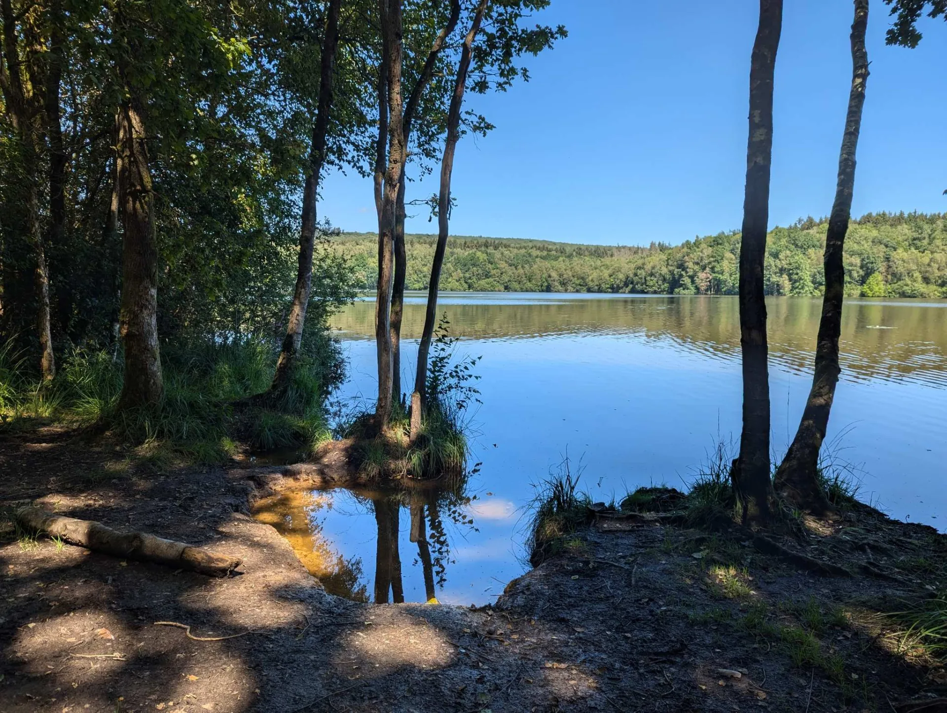
First lap around Lac des Vieilles Forges
An easy lap around the lake to start — little climbing, plenty of shade, and the water always somewhere in view. A relaxed first day, with the whole family along.
From the lake to the Pont sur le Ruisseau de Faux
The longer loop from the lake, across the Ruisseau de Faux and through extensive forest. At a good 17 kilometres and nearly 300 metres of ascent, the second-longest walk of the week.
Panorama over Revin: the loop from Anchamps
A lovely short loop up to the viewpoint over Revin, which lies far below in a bend of the Meuse. The forest floor was very wet in places that day, though, and slippery with it.
Around the lake again — this time solo
The same lake loop again, this time alone — the family were busy sunbathing and knitting. The lake lay calm in the morning, water lilies in the bays, and the lido beckoned from the far shore.
Roc la Tour and the view of Naux
In the afternoon, the short, steep climb from Tournavaux up to the Roc la Tour, a jagged quartzite tower above the valley. The rock really is worth a visit — up among the gnarled oaks the view opens wide over the heights and across to Naux.
The island of Montcy-Saint-Pierre near Charleville-Mézières
A flat stroll on the edge of Charleville-Mézières, around the Meuse island at Montcy-Saint-Pierre — past the marina and over an old suspension footbridge. Parts of it aren't very well kept, but on the whole it's well worth doing.
To the viewpoint above the Bassin de Whitaker
The longest walk to close the week: a glorious loop with babbling brooks and the tapping of a woodpecker, easy going as far as the viewpoint above the Bassin de Whitaker (at kilometre 9.4). The descent that follows is very steep, though other ways down are easy to find — just walk on a little further. Sturdy, waterproof footwear is strongly recommended here.